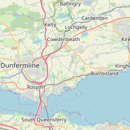
Auchtertool Map, Satellite view of Auchtertool, Fife, Scotland
Auchtertool is located in Fife County, Fife, Scotland, Scotland, United Kingdom.
Location informations of Auchtertool
Latitude of city of Auchtertool is 56.10277 and longitude of city of Auchtertool is -3.26035. Auchtertool has 1 postcode / zip code, in county of Fife.The County of Auchtertool is Fife.
Postcode / zip code of Auchtertool
KY2 5Administrative division of Auchtertool
County :FifeGPS coordinates of Auchtertool
Latitude : 56.10277Longitude : -3.26035
Online Map of Auchtertool - road map, satellite view and street view


Leaflet | © OpenStreetMap contributors
Search distance between two cities
The weather for Auchtertool in the United Kingdom
Get today and tomorrow's weather forecasts for Auchtertool. Find out the weather forecast for the week ahead and the weekend for Auchtertool in the UK.Auchtertool weather forecast 15 days
What is the nearest train station to Auchtertool?
List of Railway Stations near to AuchtertoolThe nearest railway stations to Auchtertool are listed below. Tickets are available at the train station ticket office or ticket machines.
| Name | Distances from Auchtertool |
|---|---|
| Cardenden Station | 4.28 Km |
| Lochgelly Station | 4.87 Km |
| Cowdenbeath Station | 5.24 Km |
| Burntisland Station | 5.35 Km |
| Kirkcaldy Station | 5.88 Km |
| Aberdour Station | 5.91 Km |
| Kinghorn Station | 6.51 Km |
| Dalgety Bay Station | 9.48 Km |
| Glenrothes with Thornton Station | 9.84 Km |
| Dunfermline Station | 10.29 Km |
What is the nearest Public Transport Stops to Auchtertool?
List of Stops near to AuchtertoolGetting there by public transport (nearest train, tube, overground line station and bus stops). The nearest stops to Auchtertool are listed below.
| Stop Name | Distances from Auchtertool |
|---|---|
| The Maltings Bus Stop (opp) | 35 m |
| The Maltings Bus Stop (adj) | 39 m |
| Kiwi Tavern Bus Stop (opp) | 170 m |
| Kiwi Tavern Bus Stop (adj) | 210 m |
| Newbigging Bus Stop (adj) | 426 m |
| Newbigging Bus Stop (opp) | 488 m |
| Newton Farm Bus Stop (opp) | 1.58 Km |
| Newton Farm Bus Stop (adj) | 1.59 Km |
| West Bank Cottage Bus Stop (Opp) | 1.80 Km |
| West bank Cottage Bus Stop (Opp) | 1.81 Km |
Historic Places to Visit near Auchtertool
List of Historic places near to Auchtertool
| Name | Distances from Auchtertool |
|---|---|
| Aberdour Castle | 5.76 Km |
| Kirkcaldy Museum and Art Gallery | 5.98 Km |
| Dogton Stone | 6.38 Km |
| Ravenscraig Castle | 7.48 Km |
| Dalgety, St Bridgets Kirk | 8.32 Km |
| Inchcolm Abbey | 8.49 Km |
| Dunfermline Museum | 12.56 Km |
| Andrew Carnegie Birthplace | 13.03 Km |
| Abbot House Heritage Centre | 13.05 Km |
| Dunfermline Abbey and Palace | 13.10 Km |
| Pittencrieff House Museum | 13.56 Km |
| Lochleven Castle | 13.57 Km |
| Eagle Rock, Cramond | 13.69 Km |
| Dalmeny House | 13.71 Km |
| Kinross House | 14.65 Km |
| Lauriston Castle | 14.66 Km |
Cities or Towns near Auchtertool
List of places near to
| Name | Distance |
|---|---|
| Newbigging | 0.44 Km |
| Orrock | 2.35 Km |
| Dundonald | 3.93 Km |
| Lochgelly | 4.27 Km |
| Kirkton | 4.36 Km |
| Newliston | 4.44 Km |
| Cardenden | 4.45 Km |
| Chapel | 4.69 Km |
| Bowhill | 4.91 Km |
| Jamphlars | 4.93 Km |
| Glencraig | 4.95 Km |
| Lumphinnans | 5.06 Km |
| Burntisland | 5.11 Km |
| Templehall | 5.27 Km |
| Cowdenbeath | 5.29 Km |
| Auchterderran | 5.30 Km |
| Donibristle | 5.37 Km |
| Cluny | 5.43 Km |
| Woodend | 5.70 Km |
| Easter Aberdour | 5.74 Km |
| Aberdour | 6.03 Km |
| Linktown | 6.06 Km |
| Hayfield | 6.06 Km |
| Kirkcaldy | 6.06 Km |
| Dunnikier | 6.24 Km |
| Kinghorn | 6.43 Km |
| Wester Aberdour | 6.45 Km |
| Pettycur | 6.49 Km |
| Port Brae | 6.50 Km |
| Fordell | 6.51 Km |
| Crosshill | 6.57 Km |
| Mossgreen | 6.58 Km |
| Hill of Beath | 6.75 Km |
| Smeaton | 6.89 Km |
| Pathhead | 7.16 Km |
| Lochore | 7.19 Km |
| Crossgates | 7.42 Km |
| Strathore | 7.90 Km |
| Kinglassie | 7.96 Km |
| Ballingry | 8.02 Km |
| Kelty | 8.10 Km |
| Sinclairtown | 8.23 Km |
| West Gallatown | 8.43 Km |
| Gallatown | 8.59 Km |
| Dysart | 8.79 Km |
| Panhall | 8.95 Km |
| Kingseat | 9.14 Km |
| Halbeath | 9.15 Km |
| Keltybridge | 9.16 Km |
| Fordell Firs | 9.18 Km |