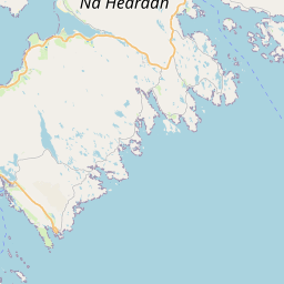
Ardslave / Àird Shleibhe Map, Satellite view of Ardslave / Àird Shleibhe, Western Isles, Scotland
Ardslave / Àird Shleibhe is located in Western Isles County, Na h-Eileanan an Iar, Scotland, Scotland, United Kingdom.
Location informations of Ardslave / Àird Shleibhe
Latitude of city of Ardslave / Àird Shleibhe is 57.80191 and longitude of city of Ardslave / Àird Shleibhe is -6.86640. Ardslave / Àird Shleibhe has 1 postcode / zip code, in county of Western Isles.The County of Ardslave / Àird Shleibhe is Western Isles.
Postcode / zip code of Ardslave / Àird Shleibhe
HS3 3Administrative division of Ardslave / Àird Shleibhe
County :Western IslesGPS coordinates of Ardslave / Àird Shleibhe
Latitude : 57.80191Longitude : -6.86640
Online Map of Ardslave / Àird Shleibhe - road map, satellite view and street view


Leaflet | © OpenStreetMap contributors
Search distance between two cities
The weather for Ardslave / Àird Shleibhe in the United Kingdom
Get today and tomorrow's weather forecasts for Ardslave / Àird Shleibhe. Find out the weather forecast for the week ahead and the weekend for Ardslave / Àird Shleibhe in the UK.Ardslave / Àird Shleibhe weather forecast 15 days
What is the nearest Public Transport Stops to Ardslave / Àird Shleibhe?
List of Stops near to Ardslave / Àird ShleibheGetting there by public transport (nearest train, tube, overground line station and bus stops). The nearest stops to Ardslave / Àird Shleibhe are listed below.
| Stop Name | Distances from Ardslave / Àird Shleibhe |
|---|---|
| Ardslave Rd End Bus Stop (at) | 12 m |
| Ardslave Rd End Bus Stop (opp) | 16 m |
| Road End Bus Stop (at) | 733 m |
| Road End Bus Stop (opp) | 744 m |
| Fish Hatchery Bus Stop (opp) | 1.02 Km |
| Fish Hatchery Bus Stop (at) | 1.03 Km |
| Township Bus Stop (N-bound) | 1.41 Km |
| Township Bus Stop (S-bound) | 1.43 Km |
| Ard Mhor Rd End Bus Stop (at) | 1.58 Km |
| Ard Mhor Rd End Bus Stop (opp) | 1.59 Km |
Historic Places to Visit near Ardslave / Àird Shleibhe
List of Historic places near to Ardslave / Àird Shleibhe
| Name | Distances from Ardslave / Àird Shleibhe |
|---|---|
| Rodel, St Clements Church | 8.97 Km |
Cities or Towns near Ardslave / Àird Shleibhe
List of places near to